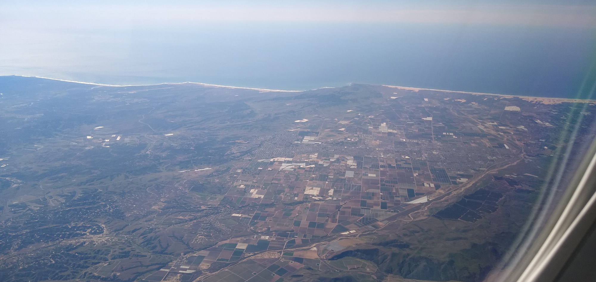
Aerial view of Santa Maria

Outdoors

Biking and mountain biking near Santa Maria

Trails and recreation areas near Santa Maria open to biking and mountain biking.

Good to know: Wilderness areas are closed to bikes; check each area’s trail rules and yield to hikers and horses.

Within 30 miles (5)

28 mi north · USDA Forest Service · Campground

Turkey Flat Ohv Staging Area

This facility does not accept reservations. Recreation Appealing to ATVs, quad runners, dual sports and single track riders, visitors will find access to 45 miles of marked and rated trails geared toward the beginner to experienced rider,…

  • Biking
  • Camping

29 mi north · USDA Forest Service · Campground

La Panza Campground

La Panza Campground is full of opportunities to relax or explore the forest. Nearby is Machesna Mountain Wilderness where hiking, hunting and horseback riding are popular. Off-high vehicle (OHV) recreation is also plentiful in the area.

  • Biking
  • Camping

29 mi southeast · USDA Forest Service · Campground

Mt. Figueroa Campground

Experience life elevated when you enjoy vistas of wildflowers, star gazing, and summer campouts atop Figueroa Mountain.

  • Biking
  • Camping

30 mi southeast · USDA Forest Service · Campground

Davy Brown Campground

Nestled on beautiful Figueroa Mountain, this charming campground sits alongside the serenely flowing Davy Brown Creek.

  • Biking
  • Camping

30 mi north · USDA Forest Service · Campground

Navajo Flats Campground

Navajo Flat Campground, off-highway vehicle (OHV) Trailhead and day use area is an ideal location for OHV enthusiasts to enjoy the many trails in the surrounding area.

  • Biking
  • Camping
  • Hiking
  • Wildlife viewing

30 to 75 miles (11)

37 mi southeast · Bureau of Reclamation

Cachuma Lake

Cachuma Reservoir, formed by Bradbury Dam , offers a prime recreational opportunity for the south central coast area of California.

  • Biking
  • Boating
  • Camping
  • Fishing
  • Hiking
  • Horseback riding
  • Hotel/Lodge/Resort Fs Owned
  • Nature education

37 mi northwest · USDA Forest Service · Campground

Cerro Alto Campground

Cerro Alto Campground is a well-known hiking and mountain biking paradise. It is located a short distance from the sandy beaches of Morro Bay, where visitors enjoy surfing, fishing, kayaking, sailing, scuba diving and more.

  • Biking
  • Boating
  • Camping
  • Fishing
  • Hiking
  • Hunting
  • Swimming
  • Water sports

45 mi southeast · USDA Forest Service · Campground

Fremont Campground

Fremont Campground is a family-friendly facility located just off California's western coast. It provides access to a variety of hiking, biking and horseback riding trails, as well as some off-road vehicle trails, in a scenic area.

  • Biking
  • Boating
  • Camping
  • Fishing
  • Horseback riding
  • Swimming

45 mi southeast · USDA Forest Service · Campground

Los Prietos

Los Prietos Campground is situated in the Los Padres National Forest and provides access to a variety of outdoor adventures, including water-related recreation and hiking.

  • Biking
  • Camping
  • Fishing
  • Swimming

46 mi east · Bureau of Land Management

Carrizo Plain National Monument

All vehicles including UTVs on the monument must be street-legal (DMV plated) and all vehicles must stay on roads. REMINDER: Please follow warning signs and respect private property when visiting your public lands.

  • Biking
  • Camping
  • Horseback riding
  • Hunting
  • Nature education
  • Photography
  • Wildlife viewing

47 mi southeast · USDA Forest Service · Campground

Upper Oso Campground

Upper Oso Campground provides ample opportunity for exploration of California's coastal mountains. It is a family-friendly campground, equipped with equestrian sites, and is close to a variety of trails and several mountain streams.

  • Biking
  • Camping
  • Fishing
  • Hiking
  • Horseback riding
  • Swimming

52 mi east · Bureau of Land Management

Temblor Recreation Area

Temblor Recreation Area was newly designated in the Bakersfield RMP (December 2014) and provides opportunities for OHV riding on a network of over 200 miles of designated routes, recreational shooting, hunting, and other dispersed forms of…

  • Biking
  • Camping
  • Hiking
  • Horseback riding
  • Hunting
  • Off-highway vehicles
  • Photography
  • Wildlife viewing

56 mi east · USDA Forest Service

Los Padres National Forest

  • Biking
  • Camping
  • Climbing
  • Hiking
  • Off-highway vehicles
  • Picnicking
  • Swimming
  • Water sports

72 mi southeast · Bureau of Reclamation

Lake Casitas

Lake Casitas is formed by Casitas Dam , which is a feature of the Ventura Project . Lake Casitas Recreation Area offers one of the nations best bass fishing areas.

  • Biking
  • Boating
  • Camping
  • Fishing
  • Hiking
  • Nature education
  • Picnicking
  • Ranger programs

73 mi north · Bureau of Land Management

Stockdale Mountain

Private property surrounds Stockdale Mountain. Do not enter through private gates or fences.

  • Biking
  • Camping
  • Hiking
  • Horseback riding
  • Hunting
  • Photography
  • Wildlife viewing

75 miles and farther (2)

77 mi north · Bureau of Land Management

Curry Mountain

Parking access onto nearly 1,800 acres of Bureau of Land Management property in this area is provided through an easement from the California Department of Fish and Game.

  • Biking
  • Camping
  • Hiking
  • Horseback riding
  • Hunting
  • Photography
  • Wildlife viewing

79 mi northwest · Bureau of Land Management

Williams Hill

Located in southern Monterey County, and standing over 2,700 feet in elevation, Williams Hill offers great views of the surrounding Salinas Valley.

  • Biking
  • Camping
  • Hiking
  • Horseback riding
  • Off-highway vehicles
  • Photography
  • Wildlife viewing

Distances are straight-line miles from downtown Santa Maria. Listings come from Recreation.gov’s federal recreation database; check each official page for hours, fees, fire restrictions and closures before you go.

More outdoors near Santa Maria

Questions

Where is the closest place for biking near Santa Maria?

Turkey Flat Ohv Staging Area (USDA Forest Service), about 28 miles north of Santa Maria as the crow flies. Next are La Panza Campground (29 mi) and Mt. Figueroa Campground (29 mi).

When is the best time for biking near Santa Maria?

Based on Santa Maria’s average highs, all year. Conditions at higher elevations can be much cooler.

Who manages these places?

Federal agencies including USDA Forest Service, Bureau of Land Management, Bureau of Reclamation. Each listing links to its official page for hours, fees, closures and current conditions.

Santa Maria AI

Your Santa Maria local guide
Hey there!

I'm Santa Maria AI. Ask about neighborhood food, independent shops, local history or planning a visit.

AI recommendations may be inaccurate. Verify hours and prices. Questions are processed by Cloudflare. Privacy